
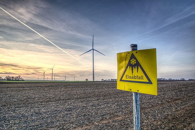
Red Flag Warnings, 50 mph Wind Gusts Fuel Wildfire Concerns Across Arizona
Arizona’s latest Wind One event has drawn urgent attention from meteorologists and fire managers. Sustained winds near 50 mph, coupled with single-digit humidity, have created conditions ripe for rapid wildfire spread. The National Weather Service has issued widespread Red Flag Warnings, signaling that even small ignition sources could evolve into uncontrollable fires. These atmospheric patterns are not isolated; they reflect a broader trend of intensifying wind-driven fire weather across the Southwest.
Understanding the Context of Wind One and Red Flag Warnings in Arizona
The Wind One event represents a convergence of meteorological extremes—low pressure gradients, dry air masses, and terrain-induced acceleration—that collectively heighten wildfire risk. In Arizona’s arid landscapes, such events often define the start of the critical fire season.
Defining the “Wind One” Event and Its Meteorological Characteristics
The Wind One episode was marked by strong westerly flow driven by a deepening trough over the Great Basin. As high pressure built to the south, pressure gradients tightened dramatically, producing gusts exceeding 50 mph in open desert corridors. These winds were most severe along mountain passes and plateau edges where channeling intensified surface flow.
Analysis of Wind Speed Patterns and Gust Behavior Across Arizona
During this event, sustained winds ranged from 25 to 35 mph across central Arizona, with peak gusts surpassing 55 mph in exposed ridgelines. Such speeds are sufficient to loft embers several miles ahead of active fire fronts. Observations indicated diurnal peaks in late afternoon when boundary layer mixing reached maximum depth.
The Influence of Regional Topography on Wind Acceleration and Dispersion
Arizona’s topography amplifies wind variability. The Mogollon Rim funnels westerly winds downslope into lower basins, while canyons near Prescott and Flagstaff experience localized turbulence that complicates forecasting. Desert basins, conversely, allow for unimpeded wind travel over long distances.
The Relationship Between Wind Events and Red Flag Warnings
Red Flag Warnings are not issued lightly; they represent a synthesis of meteorological thresholds that predict extreme fire potential. The interplay between wind intensity, humidity levels, and fuel dryness determines when these alerts are activated.
Criteria Used by the National Weather Service to Issue Red Flag Warnings
The National Weather Service typically issues a Red Flag Warning when sustained winds exceed 20 mph for several hours and relative humidity drops below 15%. These metrics indicate that any spark could ignite rapidly spreading flames across receptive fuels.
How Sustained Winds and Low Humidity Create Critical Fire Weather Conditions
Low humidity draws moisture from vegetation, transforming grasses into tinder-like fuels. When combined with strong winds, flames advance quickly across slopes and plains. Even minor shifts in wind direction can redirect fire fronts unpredictably.
The Role of Synoptic-Scale Systems in Triggering Widespread Alerts
Large-scale troughs moving through the western United States often generate high-pressure ridges downstream that accelerate surface flow. These synoptic systems create region-wide wind fields capable of triggering multiple concurrent Red Flag zones across Arizona.
Meteorological Dynamics Behind 50 mph Wind Gusts
High-magnitude gusts arise from both upper-level jet dynamics and surface pressure contrasts. Their interaction defines how intense surface winds become during events like Wind One.
Atmospheric Pressure Gradients and Jet Stream Interactions
A steep horizontal pressure gradient between northern cold air masses and southern warm air drives acceleration at lower altitudes. When aligned with jet stream cores above 30,000 feet, vertical momentum transfer intensifies gusts at ground level.
Jet Stream Positioning and Its Amplification of Surface Wind Speeds
In this case, the subtropical jet shifted northward over Arizona, enhancing upper-air divergence that deepened surface lows. This alignment magnified downward momentum transport during daytime heating cycles.
Seasonal Patterns Influencing High-Wind Events in the Southwest
Spring months frequently bring strong gradient winds as winter systems exit the Rockies while pre-monsoonal dryness persists. Historically, March through May yield Arizona’s highest frequency of wind-driven advisories.
Localized Wind Phenomena Across Arizona’s Diverse Terrain
Microclimates within Arizona produce unique wind responses even under uniform large-scale forcing. Terrain complexity turns broad meteorological setups into highly variable local outcomes.
Orographic Effects on Wind Intensity in Mountainous Regions
Mountain ridges accelerate airflow through compression effects; gusts double relative to adjacent valleys. Areas like Mount Lemmon or the San Francisco Peaks often record extreme velocities during regional wind events.
Valley Channeling and Its Role in Increasing Wind Velocity
Valleys act as natural conduits where airflow concentrates into narrow paths. During Wind One, this mechanism produced sudden bursts exceeding forecasted speeds near Verde Valley communities.
Microclimate Variations Between Northern Forests and Desert Basins
Northern pine forests retain slightly higher humidity than southern deserts but experience stronger mechanical turbulence due to canopy drag. In contrast, desert basins sustain longer-duration gusts with less frictional damping.
Fire Weather Implications of Strong Wind Events
When high winds coincide with parched fuels, wildfire behavior escalates rapidly beyond suppression capabilities. The Wind One scenario exemplifies how atmospheric forces reshape firefighting strategies statewide.
How High Winds Intensify Wildfire Behavior
Winds feed oxygen directly into combustion zones while propelling embers far ahead of main fires—a process known as spotting. Under such conditions, containment lines often fail as new ignitions leapfrog existing barriers.
Spotting Potential Due to Ember Transport Over Long Distances
Research shows embers can travel more than a mile under 50 mph gusts. That means even isolated sparks from power lines or vehicles can initiate secondary fires well outside initial perimeters.
Challenges for Containment Lines Under Shifting Wind Directions
Rapid direction changes collapse containment efforts by reversing flame fronts unexpectedly. Fire crews must constantly reposition resources based on updated mesoscale forecasts.
Assessing Fuel Conditions During Wind One
Vegetation state plays an equal role alongside weather variables in determining wildfire outcomes during events like Wind One.
Vegetation Dryness Levels Following Prolonged Drought Periods
Extended drought preceding this event left live fuel moisture below seasonal norms statewide. Grasses cured early following minimal winter precipitation across southern counties.
Curing of Fine Fuels Enhancing Ignition Probability
Fine fuels such as cheatgrass dry rapidly after brief heat spells; once cured they ignite almost instantaneously under spark exposure combined with high winds.
Influence of Temperature Fluctuations on Fuel Moisture Recovery
Nighttime temperatures remained too mild for dew formation during Wind One, preventing meaningful fuel moisture recovery before next-day heating resumed desiccation cycles.
Evaluating the Broader Significance for Future Red Flag Patterns
The recurrence of intense wind episodes signals structural shifts in regional climate behavior affecting both forecasting models and mitigation planning across Arizona’s wildland interface zones.
Trends in Frequency and Intensity of Critical Fire Weather Days
Long-term data reveal an upward trend in annual Red Flag days since the early 2000s across southwestern states—a pattern consistent with warming-induced aridity increases observed by NOAA analyses.
Climate Variability as a Factor Influencing Future Warning Frequency
El Niño–Southern Oscillation phases alter jet stream positions impacting storm tracks; La Niña years tend to favor stronger springtime gradients conducive to events like Wind One.
Emerging Correlations Between Large-Scale Climate Indices and Local Fire Risk
Studies link Pacific Decadal Oscillation cycles with multi-year clusters of elevated fire-weather frequency across interior deserts—a relationship now integrated into predictive modeling frameworks used by federal agencies.
Potential Shifts in Forecasting and Response Protocols
Forecast accuracy increasingly depends on coupling high-resolution models with real-time sensor networks tracking terrain-specific wind evolution throughout critical burn periods.
Integration of Mesoscale Modeling for Improved Wind Prediction Accuracy
Advanced mesoscale models capture localized turbulence missed by coarse global grids; these tools enhance short-term forecasts vital for tactical firefighting deployment decisions.
Adaptive Strategies for Early Warning Dissemination to Firefighting Agencies
Automated alert pipelines push updated warnings directly to incident command centers via satellite-linked systems enabling faster operational responses under changing conditions.
Enhancing Coordination Between Meteorological Services and Land Management Authorities
Joint task forces now synchronize prescribed burn scheduling with forecast windows minimizing overlap between planned activities and potential high-wind intervals like those seen during Wind One.
Mitigation Strategies Under Escalating Wind Risk Scenarios
As climate variability amplifies extreme wind potential, proactive mitigation becomes central to minimizing ignition sources and improving resilience against inevitable Red Flag days ahead.
Strengthening Fire Preparedness During High-Wind Periods
Counties implement temporary burn bans when forecasts project gust thresholds above critical limits; utilities inspect transmission corridors preemptively to reduce line faults sparking fires during peak winds.
Reinforcement of Power Infrastructure to Prevent Ignition Sources from Downed Lines
Utilities reinforce poles using composite materials less prone to failure under lateral stress loads typical during 50 mph gust events while expanding sectional shutoff protocols targeting vulnerable circuits near wildland areas.
Deployment Planning for Rapid Response Units Based on Wind Trajectory Models
Emergency planners utilize trajectory simulations predicting ember dispersal corridors allowing pre-positioning of suppression crews along likely spread vectors before ignition occurs.
Long-Term Policy Considerations for Arizona’s Fire Management Framework
Policy adaptation must integrate evolving meteorological realities into sustainable land management strategies balancing ecological health with community safety imperatives.
Incorporating Wind Event Data Into State-Level Wildfire Mitigation Planning
State agencies now embed historical Wind One-type datasets within hazard mapping tools guiding zoning restrictions around wildland–urban interfaces most exposed to recurrent high-wind threats.
Investment in Remote Sensing Technologies for Real-Time Monitoring
Satellite-based thermal anomaly detection paired with ground-based anemometers offers continuous surveillance enabling earlier intervention once ignition signatures align with active wind fields.
Cross-Agency Collaboration to Refine Thresholds for Red Flag Issuance Under Evolving Climatic Conditions
Meteorologists collaborate with forestry divisions reviewing legacy criteria ensuring warning thresholds remain relevant amid shifting baseline climates characterized by prolonged dryness cycles.
FAQ
Q1: What defines a “Wind One” event?
A: It refers to a coordinated meteorological classification denoting widespread strong winds exceeding critical thresholds capable of driving rapid fire spread across multiple forecast zones simultaneously within Arizona’s regionally linked warning system.
Q2: Why do Red Flag Warnings coincide with spring months most frequently?
A: Spring brings transitional jet patterns producing steep pressure gradients before monsoon moisture arrives; this timing aligns low humidity with strong synoptic flows ideal for ignition escalation risks.
Q3: How do firefighters adapt tactics under extreme wind conditions?
A: Crews shift toward indirect attack methods establishing containment lines far ahead while relying heavily on aerial retardant drops due to unsafe direct engagement near advancing flame fronts driven by erratic gusts.
Q4: Are urban areas also affected by these warnings?
A: Yes—urban fringes bordering undeveloped land face equal peril since embers carried miles downwind can ignite vegetation belts or residential landscaping acting as conduits into neighborhoods during Wind One-type scenarios.
Q5: Could improved forecasting reduce future wildfire losses?
A: Enhanced mesoscale modeling combined with automated alert dissemination substantially improves situational awareness allowing earlier evacuations and resource mobilization thereby reducing structural losses despite unavoidable weather extremes.